Upcoming Event
 Free Newsletter

Dorian expected to cause flash flooding across S.C.
Staff //September 4, 2019//


The first rainfall from Hurricane Dorian arrived in the Lowcountry this morning, serving as a prelude to the brunt of the storm, which experts say will reach Charleston early Thursday.
%20zl.png) Dorian remains on relatively the same northward track as Tuesday, according to the National Hurricane Center, with the center of the storm expected to travel along the S.C. coast all day tomorrow. The entire S.C. coast is under a hurricane warning.
Dorian remains on relatively the same northward track as Tuesday, according to the National Hurricane Center, with the center of the storm expected to travel along the S.C. coast all day tomorrow. The entire S.C. coast is under a hurricane warning.
Hurricane-force winds extend up to 60 miles out from the storm’s center, National Hurricane Center Director Ken Graham said in an 11 a.m. video update, though he warned that water is a more dangerous part of the storm. Graham said 90% of fatalities during hurricanes historically are water-related.
About half of South Carolina, from the coastline to Columbia, is at risk for flash flooding from rainfall, according to the National Hurricane Center, with the highest risk along the Grand Strand.
Graham noted that the danger of flash flooding isn't reserved to coastal areas and said predicted rain totals could shift depending on the movement of the storm.
%20zl.png) The National Oceanic and Atmospheric Administration is also predicting a 4- to 7-foot storm surge in the Lowcountry with Dorian and a 5- to 8-foot surge along the Grand Strand.
The National Oceanic and Atmospheric Administration is also predicting a 4- to 7-foot storm surge in the Lowcountry with Dorian and a 5- to 8-foot surge along the Grand Strand.
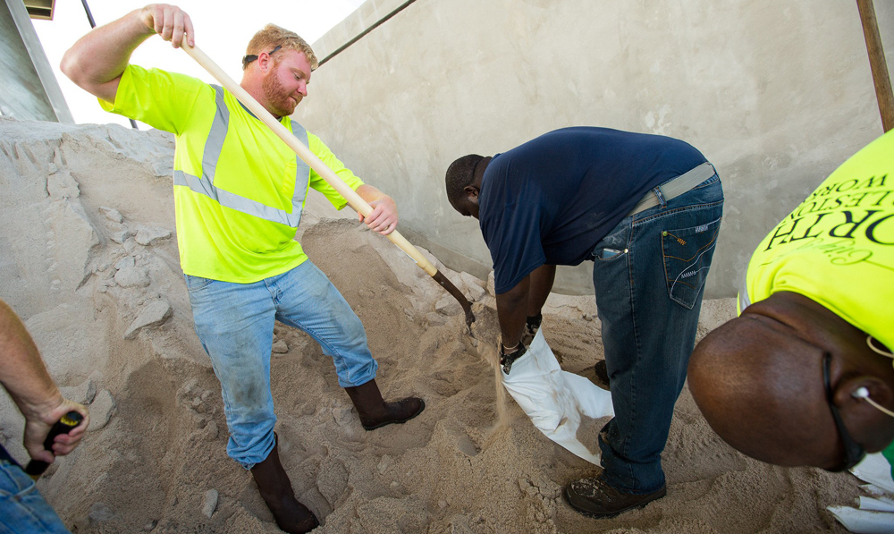
Gov. Henry McMaster said he’s “confident that we will have a lot of flooding,” across South Carolina, and the state has been moving equipment and personnel into strategic locations to prepare for recovery after the storm.
Charleston is projected to have a high tide of 10.3 feet around 1 a.m. Thursday, close to the time when Dorian will be at its strongest in the region. During Hurricane Irma, Charleston Mayor John Tecklenburg said, the city had a high tide of 9.9 feet and during Hurricane Matthew, the city saw a high tide of 9.3 feet.
The tide Thursday afternoon is projected to be 9.4 feet.
“And this is not accounting for the rain,” Tecklenburg said. “So if we get the copious amount of rain that’s projected, particularly during those times when the tide is high … the water’s got nowhere to go and it’s going to stay around.”
The lane reversal on Interstate 26 eastbound between Columbia and Charleston ended at noon today to allow crews to shelter ahead of the storm. The S.C. Department of Public Safety said that normal westbound lanes remain open but entrances onto eastbound lanes into Charleston will be blocked.
S.C. Department of Transportation Secretary Christy Hall said I-26 was seeing 3,500 cars per hour on Tuesday, above the highway’s typical capacity.
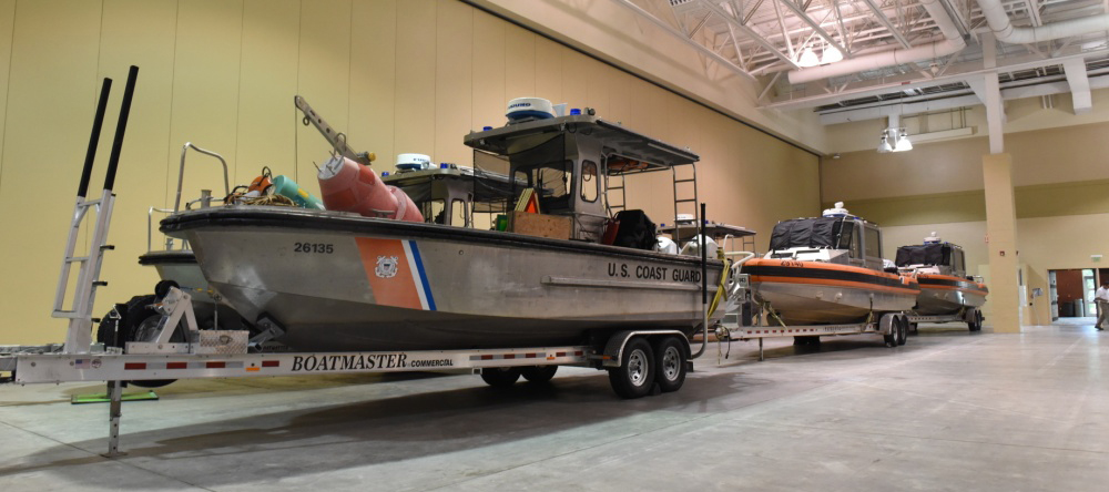 The Coast Guard warned that its search-and-rescue capabilities could be delayed or unavailable as storm conditions strengthen; it urged all boats to seek safe harbor and for beachgoers and surfers to refrain from activities in the water until Hurricane Dorian has passed.
The Coast Guard also set Charleston’s port condition at Zulu as of 8 a.m. today, meaning that sustained gale-force winds are anticipated within 12 hours. No vessels may enter or move within the port without the permission of the captain of the port until Zulu is lifted.
The S.C. Ports Authority said Inland Port Dillon is closing at 6 p.m. today and is expected to reopen Friday at 9 a.m.
Charleston County is monitoring wind speeds on various bridges throughout the county. If winds reach 30 mph, high-profile vehicles such as box trucks, tractor trailers and motor homes will be advised not to use high-span or exposed bridges such as the Arthur Ravenel Jr. Bridge. If wind speeds reach 40 mph, the bridges will be deemed not safe to travel on and law enforcement will not be available on the bridges.
“People have asked about ‘Well, when is the Ravenel Bridge closing?’ ” Tecklenburg said. “It doesn’t technically close. We don’t go out there and put barricades out, but at a certain wind speed … you’re crossing the bridge at your own risk.”
Regular bus service from the Charleston Area Regional Transportation Authority has been suspended, but CARTA is operating its hurricane evacuation shuttle in downtown Charleston until 6 p.m. today, with pickups occurring at the blue hurricane evacuation signs.
P